-42%  NA WSZYSTKIE PRODUKTY !
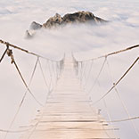
Obraz Dolina Franschhoek w zachodniej części Republiki Południowej Afryki z wieloma winnicami i Middagskransberg oraz Górami Wemmershoek w tle
Obraz:
Dolina Franschhoek w zachodniej części Republiki Południowej Afryki z wieloma winnicami i Middagskransberg oraz Górami Wemmershoek w tle.
Autor:
Numer zdjęcia:
#96901913
Słowa kluczowe:
historia, charakter, góra, wyschnięcia, chmura, niebo, spadek, jesień, Afryka
Podobne
Panorama of the red rock mountains of the Munds Mountain Wilderness and Courthouse Butte near Sedona in Northern Arizona in Coconino National Forest in the United States
The Salt River and surrounding mountains with fall colored desert shrubs in central Arizona, United States of America
Winnice przylądka Winelands w dolinie Franschhoek w zachodniej części Przylądka Południowej Afryki, wśród otaczających gór Drakenstein
Winnice na wiosnę w regionie Boland Wine of Western Cape w Republice Południowej Afryki
Winnice przylądka Winelands w dolinie Franschhoek w zachodniej części Przylądka Południowej Afryki, wśród otaczających gór Drakenstein
Panorama doliny Franschhoek w zachodniej części Przylądka Południowej Afryki z licznymi winnicami w Cape Winelands, otoczona pasmem górskim Drakenstein, widziane z przełęczy Franschhoek
Panorama of Cathedral Mountain and Munds Mountain Wilderness between the Village of Oak Creek and Sedona in northern Arizona in Coconino National Forest, United States of America
The Salt River and surrounding mountains with fall colored desert shrubs in central Arizona, United States of America
Gajów oliwnych i winnic otoczonych górami wzdłuż drogi Helshoogte między historycznymi miastami Stellenbosch i Franschhoek w regionie winiarskim w zachodniej części Afryki Południowej
Gaje oliwne i winnice otoczone górami wzdłuż Drogi Helshoogte między historycznymi miastami Stellenbosch i Franschhoek w regionie winiarskim Western Cape of South Africa
Panorama of the Red Rocks of the Munds Mountain Wilderness near the town of Sedona in northern Arizona in Coconino National Forest, USA
The red rock mountain Courthouse Butte between the Village of Oak Creek and  Sedona in Northern Arizona in Coconino National Forest in the United States
The Red Rock Mountains of Cathedral Rock, Bell Rock and Courthouse Butte between the Village of Oak Creek and Sedona in Northern Arizona in Coconino National Forest in the United States
The red rock sandstone mountains of Bell Rock, Munds Mountain and Courthouse Butte near Sedona in Northern Arizona in Coconino National Forest in the United States
The red rock mountain Courthouse Butte between the Village of Oak Creek and Sedona in Northern Arizona in Coconino National Forest in the United States
The Red Rocks the Munds Mountain, Twin Buttes and Surrounding Mountains near the town of Sedona in northern Arizona in Coconino National Forest, USA
Munds Mountain near the town of Sedona in northern Arizona in Coconino National Forest, USA
Low Clouds hanging around the Red Rocks the Munds Mountain and Surrounding Mountains near the town of Sedona in northern Arizona in Coconino National Forest, USA
Woman looking at the Red Rocks of Munds Mountain and Surrounding Mountains near the town of Sedona in northern Arizona in Coconino National Forest, USA
Low Cloud hanging around the Red Rocks of Munds Mountain after a heavy rainfall near the town of Sedona in northern Arizona in Coconino National Forest, USA
Chicken Point in the Munds Mountain Wilderness at Sedona in AZ, USA
Munds Mountain near the town of Sedona in northern Arizona in Coconino National Forest, USA
Munds Mountain and Twin Butte red rock mountains surrounding the town of Sedona
Munds Mountain and Twin Butte red rock mountains surrounding the town of Sedona, Arizona, United States
The red rock mountain Courthouse Butte between the Village of Oak Creek and Sedona in Northern Arizona in Coconino National Forest in the United States
Sunset over Thunder Mountain and other red rock mountains surrounding the town of Sedona in northern Arizona in Coconino National Forest, United States of America
Brown Grass covering the rolling Hills of the Thompson River Valley in the fall in central British Columbia, Canada
Fall Colors of the Mountains surrounding Kamloops Lake along the Trans Canada Highway in British Columbia, Canada
Clouds and blue sky over Bell Rock and Courthouse Butte between the Village of Oak Creek and the town of Sedona in northern Arizona in Coconino National Forest, United States of America
Red Rock Mountains named Bell Rock, on the left, and Courthouse Butte, on the right, near the city of Sedona in Northern Arizona in Coconino National Forest, United States
After rain showers, streams and puddles forming at Bell Rock and Courthouse Butte, famous red rocks between the Village of Oak Creek and Sedona in northern Arizona's Coconino National Forest, USA
Lee Mountain and Courthouse Butte between the Village of Oak Creek and Sedona in northern Arizona in Coconino National Forest, United States of America
Sunset over Thunder Mountain and other red rock mountains surrounding the town of Sedona in northern Arizona in Coconino National Forest, United States of America
Streams and Puddles on the Red Rocks the Munds Mountain after a heavy rainfall near the town of Sedona in northern Arizona in Coconino National Forest, USA
Clouds and blue sky over Bell Rock and Courthouse Butte between the Village of Oak Creek and the town of Sedona in northern Arizona in Coconino National Forest, United States of America
The Salt River and surrounding mountains with fall colored desert shrubs in central Arizona, United States of America
Black and White Photo of Mount Fitzwilliam, East on the Yellowhead Highway in British Columbia, Canada and part of the Canadian Rockies
Region Little Karoo w Prowincji Przylądkowej Zachodniej RPA z majestatycznymi Górami Grootswartberg na horyzoncie
Spektakularny widok na przełęcz Franschhoek, zwaną także Lambrechts Road R45, która biegnie wzdłuż Middagskransberg między Franschhoek i Villiersdorp w prowincji Western Cape w Republice Południowej A
Winnice przylądka Winelands w dolinie Franschhoek w zachodniej części Przylądka Południowej Afryki, wśród otaczających gór Drakenstein
Winnice i okoliczne góry na wiosnę w regionie winiarskim Boland w Western Cape w Republice Południowej Afryki
Wczesnym rankiem nad zachodnim wybrzeżem Kapsztad i Góra Stołowa widziane z Ou Kaapse Weg, Old Cape Road, w chłodny, zimowy poranek
Fall colors on a hiking trail in the Valley of Five Lakes Trail in Jasper National Park in the Canadian Rockies
Mount Fitzwilliam, East on the Yellowhead Highway,  part of the Canadian Rockies. The lower half is dolomite. The upper half quartzite covered with lichen that gives it a very dark gray color
Clouds and blue sky over Bell Rock and Courthouse Butte between the Village of Oak Creek and the town of Sedona in northern Arizona in Coconino National Forest, United States of America
Clouds and blue sky over Courthouse Butte between the Village of Oak Creek and the town of Sedona in northern Arizona in Coconino National Forest, United States of America
Rain pouring down on the geological formations of the red sandstone buttes surrounding the Chapel of the Holy Cross at Sedona in northern Arizona, USA
The tall sandstone butte named Chimney Rock at the town of Sedona in northern Arizona, United States of America
Rain pouring down on the geological formations of the red sandstone buttes surrounding the Chapel of the Holy Cross at Sedona in northern Arizona, USA
View of the red sandstone formations at Chicken Point viewed form the Chapel of the Holy Cross near Sedona in northern Arizona, United States of America
View of the red sandstone formations of Twin Buttes, Courthouse Butte, Bell Rock and Cathedral Rock in the valley between the Village of Oak Creek and Sedona in northern Arizona, USA
Rain pouring down on the geological formations of the red sandstone buttes surrounding the Chapel of the Holy Cross at Sedona in northern Arizona, USA
View of the red sandstone formations at Chicken Point viewed form the Chapel of the Holy Cross near Sedona in northern Arizona, United States of America
The colorful sandstone mountains of Twin Buttes and Munds Mountain near the town of Sedona in northern Arizona in Coconino National Forest, USA
Clouds and blue sky over Courthouse Butte between the Village of Oak Creek and the town of Sedona in northern Arizona in Coconino National Forest, United States of America
Clouds and blue sky over Bell Rock and Courthouse Butte between the Village of Oak Creek and the town of Sedona in northern Arizona in Coconino National Forest, United States of America
Clouds and blue sky over Courthouse Butte between the Village of Oak Creek and the town of Sedona in northern Arizona in Coconino National Forest, United States of America
Clouds hanging over the colorful sandstone mountains at the northern edge of the Village of Oak Creek in northern Arizona, in Coconino National Forest, USA
Clouds and blue sky over Bell Rock and Courthouse Butte between the Village of Oak Creek and the town of Sedona in northern Arizona in Coconino National Forest, United States of America
Streams and Puddles on the Red Rocks the Munds Mountain after a heavy rainfall near the town of Sedona in northern Arizona in Coconino National Forest, USA
Panorama of Cathedral Mountain and Munds Mountain Wilderness between the Village of Oak Creek and Sedona in northern Arizona in Coconino National Forest, United States of America
Bell Rock showing Vegetation growing on the Red Rocks and Red Soil in Coconino National Forest near Sedona in northern Arizona, USA
Sunset over Thunder Mountain and other red rock mountains surrounding the town of Sedona in northern Arizona in Coconino National Forest, United States of America
Bell Rock and Catherdral Rock in the background, famous red rocks between the Village of Oak Creek and Sedona in northern Arizona's Coconino National Forest, United States of America
Panorama with Bell Rock and Catherdral Rock in the background, famous red rocks between the Village of Oak Creek and Sedona in northern Arizona's Coconino National Forest, United States of America
Panorama of the Red Rock Mountains of Cathedral Rock, Bell Rock and Courthouse Butte between the Village of Oak Creek and  Sedona in Northern Arizona in Coconino National Forest in the United States
The red rock sandstone mountains of Bell Rock, Munds Mountain and Courthouse Butte near Sedona in Northern Arizona in Coconino National Forest in the United States
Senior Woman piesze wycieczki po alpejskich łąkach w kolorach jesieni pod pochmurnym niebem na Tod Mountain w pobliżu miejscowości Sun Peaks w obszarze Shuswap w Kolumbii Brytyjskiej, Kanada
zobacz więcejschowaj
Materiały

Obraz na płótnie

Nadruk nanoszony jest na wysokiej jakości płótno, które naciąga się na krosno malarskie (blejtramy). Dzięki temu, że nadruk pokrywa boczne krawędzie, nie ma konieczności oprawiania wzoru dodatkową ramą. Polecamy również kompozycje składające się z kilku obrazów tworzących spójną kompozycję.
  • Montaż: Obraz jest od razu gotowy do zawieszenia na ścianie. Do każdego obrazu dokładamy zawieszki i gwoździki.
  • Dodatkowe informacje: W ofercie dostępne są ramy wewnętrzne i zewnętrzne.

Zobacz również
Wąska ulica w wiosce rybackiej historyczne
Blisko Dzianina Wspólnota z Wspólny ogród w Centrum
Handlowych Sieci rybackie Wiszące się pralnia
Typowa scena z działalności miejskiego w Amsterdamie
Widok uśpiony wulkan Mount Baker z Fraser Valley
Pokryte śniegiem drzewa sosnowe w wysokich górach alpejskich
Zniszczony wolne dom z mchem na dachu w polu
Piękny bukiet fioletowych kwiatów
Kamloops Jezioro w Cariboo Region Kolumbii Brytyjskiej
Widok Fraser Canyon i okoliczne góry
Widok jeziora Kamloops w Kolumbii Brytyjskiej
Kamloops Jezioro w środkowej Kolumbii Brytyjskiej
Old Country Kościół w Spences Bridge w Fraser Canyon
Wytrzymałe Góry w Fraser Canyon w Kolumbii Brytyjskiej
Rzeka Fraser pobliżu Lytton w Fraser Canyon
Pociągi na obu stronach rzeki Fraser Canyon w
Widok na Góry Rugged w Fraser Canyon
Clock Tower of Old Country Church
Autostrady i linii energetycznych kolejowego przez Fraser Canyon
Długi Pociąg pracując przez Mighty Fraser Canyon
Owce Pióro i Spichlerz w prowincji Gelderland
Mount Baker wynika z Fraser Valley w Kolumbii Brytyjskiej
Milner Chapel behind a Picket Fence in Langley British Columbia
Kozy na łące w Fraser Valley
Przednie wejście Milner kaplicy w Langley Kolumbii Brytyjskiej
Red Horse Barn in the Fraser Valley of BC
Milner Kaplica w Langley Kolumbii Brytyjskiej
Szczyt Coquihalla Highway w Kolumbii Brytyjskiej
Mała kaplica w High Alpine
Pokryte śniegiem drzewa w High Alpine
Mała kaplica w High Alpine
Stoki narciarskie w High Alpine ośrodka narciarskiego Sun Peaks
Looking over the Fraser River at sunset near the Golden Ears bridge at Langley British Columbia
Zachód słońca nad rzeką Fraser w pobliżu Fort Langley z góry złote kłosy w tle
Red Barn w polu rolnika pod błękitne niebo w Langley Kolumbii Brytyjskiej
Suburbia w Fort Langley, zabytkowej miejscowości w Fraser Valley of British Columbia
Filly ustanawiające na łące w pobliżu Fort Langley Kolumbii Brytyjskiej
The fertile farming area of Glenn Valley in the Fraser Valley of British Columbia
Złoty Uszy Most nad rzeką Fraser łączenia miast Langley oraz Maple Ridge w Fraser Valley of British Columbia
Zachód słońca nad rzeką Fraser w pobliżu Fort Langley na miły wieczór wiosenny
Suburbia w Fort Langley, zabytkowej miejscowości w Fraser Valley of British Columbia
Żyzna Glenn obszaru hodowli Dolina w Fraser Valley of British Columbia
An old dilapidated grey Old Barn near Fort Langley under blue sky
Golden Ears mountain seen from Derby Reach in Langley British Columbia
Zachód słońca nad Farm w Fort Langley pod wielkim żółtym i grożąc nieba
Złoty Uszy Mountain widziany z Derby zasięgiem w Langley Kolumbii Brytyjskiej
Mare Wypas i Filly ustanawiające na łące w pobliżu Fort Langley Kolumbii Brytyjskiej
Złoty Uszy górskie widziany z Derby zasięgiem w Langley Kolumbii Brytyjskiej
Rzeka Coquihalla, jak wije się przez kanion w parku Othello Tunele
Klacz i Filly Wypas na łące niedaleko Fort Langley Kolumbii Brytyjskiej z ich czerwonym stodole w tle
Klacz i Filly Wypas na łące w pobliżu British Columbia Fort Langley
Autostrady i Transport kolejowy w Langley Kolumbii Brytyjskiej
Typowy krajobraz z lasów tropikalnych roślinności i potoku w lesie deszczowym na zachodnim wybrzeżu Kolumbii Brytyjskiej
Rzeka Coquihalla, jak wije się przez kanion w parku Othello Tunele
Rzeka Coquihalla jak wejdzie on w kanion w pobliżu wsi Nadziei we wschodniej Fraser Valley of British Columbia
Biały dziki kwiat w alpejskich łąkach Sun Peaks w Kolumbii Brytyjskiej
Fort Fort Trail w Derby zasięgiem w Langley Kolumbii Brytyjskiej. Ulubiona ścieżka dla chodzenie, bieganie i jazda na rowerze z Fort Langley do mostu Golden Ears
Gopher czuwać w pobliżu nory w regionie alpejskim Sun Peaks w Kolumbii Brytyjskiej
Hiking through the Wild Flowers in the High Alpine of Tod Mountain in the Sushwap Highlands and part of the Sun Peaks ski resort in central British Columbia
Mountain (liściaste) Aster w wysokiej Alpine Meadows
Wędrówki przez dzikie kwiaty w High Alpine Tod Mountain w Sushwap Highlands i część Sun Peaks ośrodek narciarski w centralnej Kolumbii Brytyjskiej
Kobieta korzystających z widoku pośród alpejskich Kwiaty w High Alpine Tod Mountain w Sushwap Highlands i część Sun Peaks ośrodek narciarski w centralnej Kolumbii Brytyjskiej w częściowo pochmurny dzi
Pearl Bordered Fritillary on Aster Flowers in the High Alpine of Tod Mountain
Wędrówki przez dzikie kwiaty w High Alpine Tod Mountain w Sushwap Highlands i część Sun Peaks ośrodek narciarski w centralnej Kolumbii Brytyjskiej
Indyjski pędzlem i Aster Kwiaty w High Alpine Tod Mountain w Sushwap Highlands i część Sun Peaks ośrodek narciarski w centralnej Kolumbii Brytyjskiej
Łąki i kwiaty na wycieczkę w Wysokich Alpine Tod Mountain w Sushwap Highlands i część Sun Peaks ośrodek narciarski w centralnej Kolumbii Brytyjskiej
Wędrówki przez dzikie kwiaty w High Alpine Tod Mountain w Sushwap Highlands i część Sun Peaks ośrodek narciarski w centralnej Kolumbii Brytyjskiej
High Alpine Meadows of British Columbia with Flowers and also showing the many Pine Beetle infected Trees.  that affect so many trees in the north western regions of North America
Wild Lupin flowers in the High Alpine of Sun Peaks ski resort in central British Columbia in the spring
Kolorowe Tod Mountain Polne kwiaty na na Alpine Village of Sun Peaks w Kolumbii Brytyjskiej
Wędrówki przez dzikie kwiaty w High Alpine Tod Mountain w Sushwap Highlands i część Sun Peaks ośrodek narciarski w centralnej Kolumbii Brytyjskiej
High Alpine Meadows of British Columbia z kwiatami, a tym samym pokazując wiele zainfekowanych drzew sosnowych beetle. To wpływa na tak wiele drzew w północno-zachodnich regionach Ameryki Północnej
Kobieta odpoczynku na pniu podczas wędrówki na szczyt góry w Tod Highlands i części Sushwap w Sun Peaks ośrodek narciarski w centralnej Kolumbii Brytyjskiej
zobacz więcejschowaj

Nasz sklep internetowy używa plików cookies i pokrewnych technologii. Dzięki nim zapewniamy najwyższą jakość świadczonych usług i gwarantujemy płynne działanie strony. Po uzyskaniu Twojej zgody, pliki cookies będą również wykorzystane do dodatkowych pomiarów i analizy korzystania z witryny. Pozwoli nam to dostosować stronę do Twoich zainteresowań oraz prezentować spersonalizowane treści i reklamy.
Administratorem Twoich danych jest Fairbox Sp. z o.o., a w niektórych sytuacjach także nasi partnerzy, z którymi współpracujemy. Szczegółowe informacje dotyczące korzystania z plików cookie oraz przetwarzania Twoich danych osobowych znajdziesz w naszej Polityce Prywatności i Cookies.
Ustawienia plików cookies
Poniżej znajdziesz opisy poszczególnych kategorii plików cookies oraz możliwość dostosowania ich do swoich preferencji:
Niezbędne
Używamy ich do zapewnienia poprawnego działania strony internetowej. Dzięki nim możesz bez zakłóceń poruszać się po naszym sklepie, a także bezpiecznie dokonywać zakupów.
Funkcjonalne
Służą do zapamiętywania wyborów dokonanych przez użytkowników na stronie, co pomaga dostosować witrynę do Twoich personalnych preferencji i poprawić komfort jej użytkowania.
Analityczne
Analityczne pliki cookies mierzą ilość wizyt i zbierają informacje o źródłach ruchu na stronie. Dzięki nim możemy zrozumieć sposób w jaki użytkownicy korzystają z witryny, doskonalić jakość usług oraz dostosowywać zawartość sklepu, aby lepiej spełniała oczekiwania naszych Klientów.
Marketingowe
Marketingowe pliki cookies umożliwiają nam i naszym partnerom dostosowanie treści reklamowych do Twoich zainteresowań. Służą także do wyświetlania reklam na innych stronach internetowych.