-42%  NA WSZYSTKIE PRODUKTY !
Plakat View on Gyachung Kang and Hungchi from Goky Ri peak. Everest view point
Plakat:
View on Gyachung Kang and Hungchi from Goky Ri peak. Everest view point.
Autor:
Numer zdjęcia:
#238226621
Słowa kluczowe:
podróżować, Nepal, flagi modlitewne, niebieski, turystyka, krajobraz, góra, charakter, szczyt
Podobne
Wooden bridge on the Gokyo Ri trek with Dudh Koshi Waterfall in the background. Between Phortse Tenga and Dole.
Yak (Bos Grunniens) transporting goods on the Gokyo Ri Trek (Everest) in Phortse Tenga.
Prayer Flags on Gokyo Ri peak with Cho oyu and Tenzing peak in the background.
View on Cho You and Tenzing peak from Gokyo Ri. Everest view point.
Panorama view on macchermo, Pharilapcha and Dole from Thare.
View on macchermo, Pharilapcha and Dole from Thare.
Hikers crossing Ngozumpa glacier (longest Himalayan glacier). Stone covered glacier.
Ngozumpa glacier (longest Himalayan glacier). Stone covered glacier.
Panorama of Ngozumpa glacier (longest Himalayan glacier) with Everest, cho la, and lobuche in the background. Stone covered glacier.
Ngozumpa glacier (longest Himalayan glacier). Stone covered glacier.
Summit of Mount Everest covered in clouds. Photographed from Gokyo Ri. One of the best view points on Everest.
View from Gokyo Ri on Mount Everest, ngozumpa glacier, cho la, lobuche west, kala patter and louche east.
Summit of Mount Everest photographed from Gokyo Ri. One of the best view points on Everest.
View on Gokyo from Gokyo Ri Peak with prayer flags in the foreground
Panorama view from Gokyo Ri Peak. Aerial view on Gokyo Lake, Gokyo Village and Ngozumpa glacier. Taboche and Cholatse Peak in the background.
View on Gokyo and ngozumpa glacier (longest Himalayan glacier) from Gokyo Ri Peak with prayer flags in the foreground
Pharilapcha Peak and renjo la pass (part of the three passes trek) in golden sunrise light. Photographed from Gokyo Ri peak.
Pharilapcha Peak with beautiful golden sunrise light. Photographed from Gokyo Ri peak.
Pharilapcha Peak and renjo la pass (part of the three passes trek) in golden sunrise light. Photographed from Gokyo Ri peak.
Wild Yak (Bos mutus) close to Gokyo Ri Peak watching into the sunrise. With Pharilapcha Peak in the background.
Wild Yak (Bos mutus) close to Gokyo Ri Peak watching into the sunrise.
Gokyo Village with Gokyo Lake in the Foreground and Kangchung Peak in the Background. Gokyo Ri on the left side (Beautiful view point on Mt. Everest)
Gokyo Lake. Ice mountain lake in front of Gokyo Ri in the Everest area. Next to Ngozumpa glacier. 4900 meter over sea level.
View on Ngozumpa glacier (longest glacier in the Himalayas) from Dole. Cho La pass, Kangchung peak and Taboche Peak in the Background
View on Dole on the Gokyo Ri Trek in the Everest area, Nepal. Khumbi Yul Lha peak in the background as well as a day moon.
View on Phortse from Kyangjuma on the gokyo ri and Everest base camp trek.
Dudh Koshi river on the Gokyo Ri trek.  Between Phortse Tenga and Dole.
Peak surrounded with clouds from Everest view point before Namche Bazar on the Everest base camp trek.
Peak of Mount Everest from the first view point on the Everest base camp trek. Between Phakding and Namche Bazar.
Namche bazar covered in fog. Moody Atmosphere.
Machapuchare (Fish tail) mountain. Impressive peak with dramatic, beautiful cloud formations. Holy mountain.
Sunrise view on Annapurna Mountain Range from Poon Hill. Viewpoint on the Annapurna Circuit.
Sunrise panorama view on Annapurna Mountain Range from Poon Hill. Viewpoint on the Annapurna Circuit.
Muktinath, town on Annapurna circuit. First village after Thorong la pass.
Golden mountain peak during the final climb of Thorong La pass.
View on Thorong La pass from Thorong High Camp view point.
Chuli East glacier from Thorong la high Camp view point.
Thorung Pedi from Thorong High Camp view Point. Tea House / Guest house before steep climb up to Thorong High Camp.
Panoramic view of the mountain range from Thorong High Camp.
Scenic view from Thorong high Camp view Point.
Two small Nepali meadow huts on the Annapurna circuit close to Yak Kharka.
Trail to Tilicho Base Camp through dangerous land slide zone. Side trek of Annapurna circuit.
Nepali carries Wood planks through a dangerous landslide zone. Building material for a new building at tilicho base camp. Side Trail from Annapurna circuit.
Trail to Tilicho Base Camp through dangerous land slide zone. Side trek of Annapurna circuit.
Khangsar Valley photographed from the trail to Tilicho Base Camp. Side trek from Annapurna circuit in Nepal. Himalaya.
View from hiking trail up to tilicho lake. Highest Mountain lake (4919 m over sea). Side trek of Annapurna circuit. Beautiful snowy mountain range and barren alpine terrain.
Tilicho lake. Beautiful blue mountain lake on a side trail from the Annapurna circuit.
Panorama of Tilicho lake. Beautiful blue mountain lake on a side trail from the Annapurna circuit.
View from hiking trail up to tilicho lake. Highest Mountain lake (4919 m over sea). Side trek of Annapurna circuit. Beautiful snowy mountain range and barren alpine terrain.
Tillicho Peak (7134m) photographed from Tilicho Lake. Side Trek from Annapurna circuit.
Tillicho Base Camp with trail back to Manang in the background. Impressive mountain scenery.
Mountain range on the eastern side of the Annapurna circuit. Photographed 2015, five months after the big earthquake.
Manang Town (Upper Manang) on the Annapurna circuit. Popular stop for acclimatisation during the Annapurna circuit.
Gangapurna from upper Manang with Marsyangdi and prayer flags in the foreground. Acclimatization walk on the Annapurna circuit.
Mountain range on the eastern side of the Annapurna circuit. Photographed 2015, five months after the big earthquake.
View from the summit (peak) of Säntis in summer, Canton Appenzell, Switzerland
View on Säntis summit station from Lisengrat. Weather station.
View from Trail to Säntis, Tierwis, from Wildhaus, Unterwasser.
Herd of Capricorns on a alpine mountain trail between Rotsteinpass and Wildhauser Schafberg on the rocky ridge line. In the Alpstein area, Säntis, Swiss alps. Found while Trail running.
Lisengrat (Ridge line) and Altmann (Impressive Mountain) photographed from Chalbersäntis close to Säntis.
Alpine hiking trail up to Säntis, between Wildhauser Schafberg and Rotsteinpass. Alpine Trail from Wildhaus to Säntis via Gamplüt, Rotsteinpass and Lisengrat.
Schafbergwand, impressive mountain wall in the Alpstein area. Säntis. Wildhaus. Unterwasser.
zobacz więcejschowaj
Materiały

Plakat standard

Plakaty drukowane na wysokiej jakości papierze. Zastosowanie technologii HP Latex zapewnia żywe kolory na lata, które są odporne na szkodliwe działanie promieni UV. Plakaty standard drukowane są na półbłyszczącym papierze.
  • Gramatura: 200g/m2
  • Dodatkowe informacje: Do plakatów dostępne są ramy aluminiowe i antyramy.

Plakat premium

Plakaty drukowane w bardzo wysokiej rozdzielczości (1440 dpi) na znakomitej jakości papierze. Zastosowanie technologii HP Latex zapewnia żywe kolory na lata, które są odporne na szkodliwe działanie promieni UV. Plakaty świetnie prezentują się w aluminiowych ramach z płytą pleksi, która nadaje całości elegancki charakter. Plakaty premium drukowane są na półbłyszczącym papierze.
  • Gramatura: 300g/m2
  • Dodatkowe informacje: Do plakatów dostępne są ramy aluminiowe i antyramy.

Zobacz również
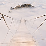
Foggy steep rope climb up to Mount Kinabalu, Malaysia, Borneo. Kota Kinabalu.
Bornean Keeled Pit Viper - Tropidolaemus subannulatus in Bako National Park, Malaysia, Borneo. During night. Closeup of the head on a tree. Green snake.
Long tailed macaque (Macaca fascicularis) in Bako Nationalpark, Malaysia, Borneo. looking in camera while sitting on a tree in sunset light.
Young male cheetah (Acinonyx jubatus) in Etosha Nationalpark, Namibia.  Leaning on car window.
Nile monitor (Varanus niloticus) hanging on a tree besides Okavango delta in Botswana. Leguan, big lizard taking a sun bath. Photograph through branches.
Big blue 70-liter backpack next to prayer flagstaff on the Everest base camp trek close to Namche Bazar, Nepal. Blue sky with clouds and mountains in the background.
Koh Bida Nok, island surrounded with the best dive sites of Koh phi phi. Rocky island with trees in open water.
Small local fish market selling fresh fish next to the dusty street under questionable hygienic conditions in Borneo. In Taman Mesra Bako, Sarawak/Malaysia.
Dramatic clouds over an wheat field during sunset in Dällikon, Zürich, Switzerland.
Kuala Lumpur Tower in between Palms and blue sky.
Urdenbahn cable car disappearing in the thick Fog in Arosa, Switzerland. Connection between Arosa and Lenzerheide.
Hunting African fish eagle (Haliaeetus vocifer) in Botswana (Botsuana). African osprey. Okavango Delta.
Grey reef sharked sold on a market in little India. (Tekka food centre) Fishmonger.
Bornean bearded pig (Sus barbatus) on the beach in Bako national park, Kuching, Sarawak, Borneo, Malaysia.
Hunting African fish eagle (Haliaeetus vocifer) in Botswana (Botsuana). African osprey. Okavango Delta. Flying.
Young male cheetah (Acinonyx jubatus) in Etosha Nationalpark, Namibia.  Leaning on car window and showing his teeth.
Female Roan antelope (Hippotragus equinus) next to a waterhole in Mahango Game reserve, Namibia.
Common tsessebe (Damaliscus lunatus lunatus) in mahango game reserve, Namibia.
Bornean orangutan [Pongo pygmaeus] hanging on a tree and eating bamboo while watching it's surroundings.
Mangrove Jungle-flycatcher (Cyornis rufigastra) sitting on a branch in the jungle next to Kinabatang river during night. Bird with yellow belly.
Lägerngratweg in Otelfingen, Zurich, Switzerland. Ridgeline on the mountain ''Lägern''. Trailrunning on technical rocky terrain and ridges. Lägernwacht. Jurahöhenweges (Jura Mountain Trail).
Pied crow (Corvus albus) in Etosha Nationalpark, Namibia. Africa.
Sunset on Mount Kinabalu with amazing cloudscape, Hanau, Sabah, Borneo, Malaysia.
Marsyangdi River on the Annapurna circuit. Eastern beginning of the trail, close to Besisahar and Syange.
Prater Hauptallee in Vienna, Austria. Kilometer 35 marking of project 1:59.
Green rice field terraces around Bhulbhule and Ghermu. On the eastern part of the Annapurna circuit.
Summit of Mount Kinabalu, the highest mountain of Malaysia, from an airplane window. Dramatic, impressive, nice clouds around the mountain. 4095 meters high.
Lägerngratweg in Otelfingen, Zurich, Switzerland. Ridgeline on the mountain ''Lägern''. Trailrunning on technical rocky terrain and ridges. Lägernwacht. Jurahöhenweges (Jura Mountain Trail).
Sunset in Desa Bugis, facing Desa Sangia. Indonesia, Lima, West Nusa Tengara. Lake with mosque in Background.
Old dusty scooter in a small alley of Jaisalmer, Rajasthan, India. Piago. Pile of Garbage bags recognisable in the background.
White rhinoceros (Ceratotherium simum) in the Namibian desert close to the Waterberg plateau.
Trail runner running up the technical trail to Tierwis and Säntis. Trail running around Wildhaus, Unterwasser in Kanton Appenzell / St.Gallen, Switzerland.
Herd of Capricorns on a alpine mountain trail between Rotsteinpass and Wildhauser Schafberg on the rocky ridge line. In the Alpstein area, Säntis, Swiss alps. Found while Trail running.
Nile crocodile (Crocodylus niloticus) taking a sun bath on a river bank in Bwabwata National Park, Kwando Core Area, Kongola, Namibia.
View from the summit (peak) of Säntis in summer, Canton Appenzell, Switzerland
Schafbergwand, impressive mountain wall in the Alpstein area. Säntis. Wildhaus. Unterwasser.
Waterfall on the Annapurna circuit between Bhulbhule and Chamje. Eastern beginning of the Annapurna circuit.
Group of hiker on the Annapurna circuit. Hiking close to Tal with Himalayan Mountains in the Background.
Khatung Kang Peak close to tilicho lake base camp. Impressive rocky Mountain. Very distinct separation between the rocky part and the grassy overgrown part.
Vehicle road from Besisahar to Manang. New road, on the Annapurna circuit, blasted into a step cliff next to Marsyangdi river. Hikers highlight the impressive cliff.
Imposing Spitzmeilen peak from Spitzmeilenhütte SAC (2085m), Flumserberge, Switzerland. Signpost with different directions and time expectations (for Hikers).
Manang airport photographed from the Annapurna circuit. One of the highest airports in the World and the highest in Nepal. Serving Manang valley, located 2.5 km east of Manang. Trekking Checkpoint.
Gangapurna from upper Manang with Marsyangdi and prayer flags in the foreground. Acclimatization walk on the Annapurna circuit.
Manang Town (Upper Manang) on the Annapurna circuit. Popular stop for acclimatisation during the Annapurna circuit.
Tilicho lake. Beautiful blue mountain lake on a side trail from the Annapurna circuit.
Herd of Capricorns on a alpine mountain trail between Rotsteinpass and Wildhauser Schafberg on the rocky ridge line. In the Alpstein area, Säntis, Swiss alps. Found while Trail running.
Khangsar Valley photographed from the trail to Tilicho Base Camp. Side trek from Annapurna circuit in Nepal. Himalaya.
Muktinath, town on Annapurna circuit. First village after Thorong la pass.
Two small Nepali meadow huts on the Annapurna circuit close to Yak Kharka.
Panoramic view of the mountain range from Thorong High Camp.
Scenic view from Thorong high Camp view Point.
Chuli East glacier from Thorong la high Camp view point.
View on Thorong La pass from Thorong High Camp view point.
Nepali men crosses Kali Gandaki (River) by foot with a walking stick.
Trail to Tilicho Base Camp through dangerous land slide zone. Side trek of Annapurna circuit.
Nepali carries Wood planks through a dangerous landslide zone. Building material for a new building at tilicho base camp. Side Trail from Annapurna circuit.
Summit of Mount Kinabalu, the highest mountain of Malaysia, from an airplane window. Dramatic, impressive, nice clouds around the mountain. 4095 meters high.
View from hiking trail up to tilicho lake. Highest Mountain lake (4919 m over sea). Side trek of Annapurna circuit. Beautiful snowy mountain range and barren alpine terrain.
Gate at the start of the Annapurna circuit. Unofficial beginning of the trek. Eastern beginning of the trail, close to Besisahar and Syange, Nepal.
Khangsar Valley photographed from the trail to Tilicho Base Camp. Side trek from Annapurna circuit in Nepal. Himalaya.
Mountain range on the eastern side of the Annapurna circuit. Photographed 2015, five months after the big earthquake.
Golden mountain peak during the final climb of Thorong La pass.
Thorung Pedi from Thorong High Camp view Point. Tea House / Guest house before steep climb up to Thorong High Camp.
Nepali carries Wood planks through a dangerous landslide zone. Building material for a new building at tilicho base camp. Side Trail from Annapurna circuit.
Trail to Tilicho Base Camp through dangerous land slide zone. Side trek of Annapurna circuit.
View from hiking trail up to tilicho lake. Highest Mountain lake (4919 m over sea). Side trek of Annapurna circuit. Beautiful snowy mountain range and barren alpine terrain.
Panorama of Tilicho lake. Beautiful blue mountain lake on a side trail from the Annapurna circuit.
View from hiking trail up to tilicho lake. Highest Mountain lake (4919 m over sea). Side trek of Annapurna circuit. Beautiful snowy mountain range and barren alpine terrain.
Tillicho Base Camp with trail back to Manang in the background. Impressive mountain scenery.
Mountain range on the eastern side of the Annapurna circuit. Photographed 2015, five months after the big earthquake.
Alpine hiking trail up to Säntis, between Wildhauser Schafberg and Rotsteinpass. Alpine Trail from Wildhaus to Säntis via Gamplüt, Rotsteinpass and Lisengrat.
Small wooden bridge to cross a stream on the eastern side of the Annapurna circuit.
Long suspension bridge to Ngadi. Bridge across Marsyangdi river on the Annapurna circuit.
Waterfall behind Tal, a village on the eastern side of the Annapurna circuit.
zobacz więcejschowaj

Nasz sklep internetowy używa plików cookies i pokrewnych technologii. Dzięki nim zapewniamy najwyższą jakość świadczonych usług i gwarantujemy płynne działanie strony. Po uzyskaniu Twojej zgody, pliki cookies będą również wykorzystane do dodatkowych pomiarów i analizy korzystania z witryny. Pozwoli nam to dostosować stronę do Twoich zainteresowań oraz prezentować spersonalizowane treści i reklamy.
Administratorem Twoich danych jest Fairbox Sp. z o.o., a w niektórych sytuacjach także nasi partnerzy, z którymi współpracujemy. Szczegółowe informacje dotyczące korzystania z plików cookie oraz przetwarzania Twoich danych osobowych znajdziesz w naszej Polityce Prywatności i Cookies.
Ustawienia plików cookies
Poniżej znajdziesz opisy poszczególnych kategorii plików cookies oraz możliwość dostosowania ich do swoich preferencji:
Niezbędne
Używamy ich do zapewnienia poprawnego działania strony internetowej. Dzięki nim możesz bez zakłóceń poruszać się po naszym sklepie, a także bezpiecznie dokonywać zakupów.
Funkcjonalne
Służą do zapamiętywania wyborów dokonanych przez użytkowników na stronie, co pomaga dostosować witrynę do Twoich personalnych preferencji i poprawić komfort jej użytkowania.
Analityczne
Analityczne pliki cookies mierzą ilość wizyt i zbierają informacje o źródłach ruchu na stronie. Dzięki nim możemy zrozumieć sposób w jaki użytkownicy korzystają z witryny, doskonalić jakość usług oraz dostosowywać zawartość sklepu, aby lepiej spełniała oczekiwania naszych Klientów.
Marketingowe
Marketingowe pliki cookies umożliwiają nam i naszym partnerom dostosowanie treści reklamowych do Twoich zainteresowań. Służą także do wyświetlania reklam na innych stronach internetowych.