-42%  NA WSZYSTKIE PRODUKTY !
Obraz World map with flags. Cylindrical stereographic projection. Map of the world with meridians on dark background. Vector illustration.
Obraz:
World map with flags. Cylindrical stereographic projection. Map of the world with meridians on dark background. Vector illustration..
Autor:
Numer zdjęcia:
#184917343
Słowa kluczowe:
ziemia, flaga, mapa, ilustracja, europa, wektor, podróżować, symbol, kraj
Podobne
World map with flags. Kavrayskiy VII pseudocylindrical projection. Map of the world with meridians on dark background. Vector illustration.
World Map. equirectangular (plate carree) projection. Map of the world with meridians on blue background. Vector illustration.
Globe centered to France. Country highlighted with green color on world map. Satellite world projection. Beautiful vector illustration.
Globe centered to Guyana. Country highlighted with green color on world map. Satellite projection view. Vector illustration.
Worldmapwith flags of each country. Larrivee projection. Map of the world with meridians on dark background. Vector illustration.
World Map. Winkel tripel projection. Map of the world with meridians on blue background. Vector illustration.
World Map Vector. Rectangular (War Office) polyconic projection. World in red orange gradient on deep blue ocean waves. Superb vector illustration.
Shape of the Finland in context of neighbour countries. Country highlighted with red color on world map. Finland map template. Vector illustration.
World Map Vector. Ginzburg IV projection. World in red orange gradient on deep blue ocean waves. Elegant vector illustration.
World Map Vector. Laskowski tri-optimal projection. World in red orange gradient on deep blue ocean waves. Radiant vector illustration.
World Map Vector. Herbert Hufnage's pseudocylindrical equal-area projection. World in red orange gradient on deep blue ocean waves. Authentic vector illustration.
Globe centered to Lebanon. Country highlighted with green color on world map. Satellite world projection. Vibrant vector illustration.
World Map Vector. Armadillo projection. World in red orange gradient on deep blue ocean waves. Astonishing vector illustration.
Shape of the Thailand in context of neighbour countries. Country highlighted with red color on world map. Thailand map template. Vector illustration.
World Map Vector. Ginzburg V projection. World in red orange gradient on deep blue ocean waves. Modern vector illustration.
The World map. World poster with regions. Shape of The World with world name. Beautiful vector illustration.
Iowa icon. Us state map on dark background. Stylish Iowa map with us state name. Vector illustration.
Dark globe centered to Peru. Country highlighted with red color on world map. Satellite world projection. Creative vector illustration.
Dark globe centered to Zambia. Country highlighted with red color on world map. Satellite world projection. Superb vector illustration.
Dark globe centered to Bolivia. Country highlighted with red color on world map. Satellite world projection. Vibrant vector illustration.
Polygonal map of the world. Robinson projection of the world. Purple Shades colored polygons. Energetic vector illustration.
Globe centered to Brazil. Country highlighted with green color on world map. Satellite world projection. Vibrant vector illustration.
Globe centered to Indonesia. Country highlighted with green color on world map. Satellite world projection. Artistic vector illustration.
Globe centered to Niger. Country highlighted with green color on world map. Satellite world projection. Amazing vector illustration.
Vector map of the world. Bromley projection of the world. Grey Shades colored polygons. Creative vector illustration.
Abstract geometric world map. Waldo R. Tobler's hyperelliptical projection of the world. Red Shades colored polygons. Elegant vector illustration.
Polygonal world map. Hill eucyclic projection of the world. Brown Blue Green colored polygons. Trending vector illustration.
Abstract world map. Eckert III projection of the world. Red Purple colored polygons. Stylish vector illustration.
Polygonal map of the world. Fahey pseudocylindrical projection of the world. Red Grey colored polygons. Awesome vector illustration.
World Map. Mollweide projection interrupted into two (equal-area) hemispheres. Map of the world with meridians on blue background. Vector illustration.
World Map. Gnomonic projection. Map of the world with meridians on blue background. Vector illustration.
Rarotonga icon. Island map on dark background. Stylish Rarotonga map with island name. Vector illustration.
Low poly world map. Peirce quincuncial projection of the world. Brown Blue Green colored polygons. Trending vector illustration.
Map of Afghanistan. Mosaic style map with flag of Afghanistan. Actual vector illustration.
Shape of the Jamaica in context of neighbour countries. Country highlighted with red color on world map. Jamaica map template. Vector illustration.
World Map Vector. Craig retroazimuthal projection. World in red orange gradient on deep blue ocean waves. Stylish vector illustration.
World Map Vector. Eckert VI projection. World in red orange gradient on deep blue ocean waves. Authentic vector illustration.
Shape of the Chile in context of neighbour countries. Country highlighted with red color on world map. Chile map template. Vector illustration.
Dark globe centered to Hungary. Country highlighted with red color on world map. Satellite world projection. Attractive vector illustration.
Dark globe centered to Greenland. Country highlighted with red color on world map. Satellite world projection. Trendy vector illustration.
Dark globe centered to Finland. Country highlighted with red color on world map. Satellite world projection. Beautiful vector illustration.
Dark globe centered to Ecuador. Country highlighted with red color on world map. Satellite world projection. Appealing vector illustration.
Dark globe centered to Nicaragua. Country highlighted with red color on world map. Satellite world projection. Attractive vector illustration.
Dark globe centered to Ireland. Country highlighted with red color on world map. Satellite world projection. Beautiful vector illustration.
Shape of the Armenia in context of neighbour countries. Country highlighted with red color on world map. Armenia map template. Vector illustration.
Shape of the Libya in context of neighbour countries. Country highlighted with red color on world map. Libya map template. Vector illustration.
Dark globe centered to Montenegro. Country highlighted with red color on world map. Satellite world projection. Powerful vector illustration.
Dark globe centered to South Korea. Country highlighted with red color on world map. Satellite world projection. Trendy vector illustration.
The World vintage map. Grunge poster with map of the world in retro color palette. Shape of The World with sunburst rays background. Vector illustration.
Dark globe centered to Dominicana. Country highlighted with red color on world map. Satellite world projection. Vibrant vector illustration.
Shape of the Latvia in context of neighbour countries. Country highlighted with red color on world map. Latvia map template. Vector illustration.
Dark globe centered to Argentina. Country highlighted with red color on world map. Satellite world projection. Attractive vector illustration.
Dark globe centered to Qatar. Country highlighted with red color on world map. Satellite world projection. Vibrant vector illustration.
Dark globe centered to Moldova. Country highlighted with red color on world map. Satellite world projection. Classy vector illustration.
Dark globe centered to Colombia. Country highlighted with red color on world map. Satellite world projection. Elegant vector illustration.
Dark globe centered to Malaysia. Country highlighted with red color on world map. Satellite world projection. Vibrant vector illustration.
Dark globe centered to Congo. Country highlighted with red color on world map. Satellite world projection. Creative vector illustration.
Dark globe centered to Guyana. Country highlighted with red color on world map. Satellite world projection. Amazing vector illustration.
Dark globe centered to Azerbaijan. Country highlighted with red color on world map. Satellite world projection. Classy vector illustration.
Dark globe centered to Armenia. Country highlighted with red color on world map. Satellite world projection. Authentic vector illustration.
Dark globe centered to Mexico. Country highlighted with red color on world map. Satellite world projection. Creative vector illustration.
Dark globe centered to Yemen. Country highlighted with red color on world map. Satellite world projection. Radiant vector illustration.
Dark globe centered to Romania. Country highlighted with red color on world map. Satellite world projection. Amazing vector illustration.
Dark globe centered to Nepal. Country highlighted with red color on world map. Satellite world projection. Beautiful vector illustration.
Dark globe centered to Burkina Faso. Country highlighted with red color on world map. Satellite world projection. Modern vector illustration.
Dark globe centered to Australia. Country highlighted with red color on world map. Satellite world projection. Captivating vector illustration.
Dark globe centered to Slovakia. Country highlighted with red color on world map. Satellite world projection. Neat vector illustration.
Dark globe centered to Kyrgyzstan. Country highlighted with red color on world map. Satellite world projection. Stylish vector illustration.
Dark globe centered to Kazakhstan. Country highlighted with red color on world map. Satellite world projection. Powerful vector illustration.
Dark globe centered to Philippines. Country highlighted with red color on world map. Satellite world projection. Elegant vector illustration.
Dark globe centered to Guinea-Bissau. Country highlighted with red color on world map. Satellite world projection. Radiant vector illustration.
Dark globe centered to Syria. Country highlighted with red color on world map. Satellite world projection. Superb vector illustration.
Dark globe centered to Bangladesh. Country highlighted with red color on world map. Satellite world projection. Neat vector illustration.
Triangular mesh of the world. Modified stereographic projection for Europe and Africa of the world. Spectral colored polygons. Contemporary vector illustration.
World map with vibrant triangles. Cylindrical equal-area projection of the world. Purple Green colored polygons. Creative vector illustration.
Dark globe centered to Brazil. Country highlighted with red color on world map. Satellite world projection. Amazing vector illustration.
Dark globe centered to Angola. Country highlighted with red color on world map. Satellite world projection. Appealing vector illustration.
Shape of the Switzerland in context of neighbour countries. Country highlighted with red color on world map. Switzerland map template. Vector illustration.
Low poly design of the world. Pseudocylindrical equal-area Goode homolosine projection of the world. Red Purple colored polygons. Amazing vector illustration.
Dark globe centered to Togo. Country highlighted with red color on world map. Satellite world projection. Vibrant vector illustration.
zobacz więcejschowaj
Materiały

Obraz na płótnie

Nadruk nanoszony jest na wysokiej jakości płótno, które naciąga się na krosno malarskie (blejtramy). Dzięki temu, że nadruk pokrywa boczne krawędzie, nie ma konieczności oprawiania wzoru dodatkową ramą. Polecamy również kompozycje składające się z kilku obrazów tworzących spójną kompozycję.
  • Montaż: Obraz jest od razu gotowy do zawieszenia na ścianie. Do każdego obrazu dokładamy zawieszki i gwoździki.
  • Dodatkowe informacje: W ofercie dostępne są ramy wewnętrzne i zewnętrzne.

Zobacz również
Tilicho górskie w Himalajach, Nepal
Yak w górach śniegu na trek do obozu bazowego Everest. Himalaje, Nepal
mt. Everest o wschodzie słońca z Kala Patthar View Point
Szczyt wulkanu Rinjani
WC w Himalajach, Nepalu
Katmandu
Ngazumba lodowiec w everest obszarze, Himalaje, Nepal
Świece w pobliżu Boudnath STUP w Katmandu, Nepal
Cień autostopowicza na drodze
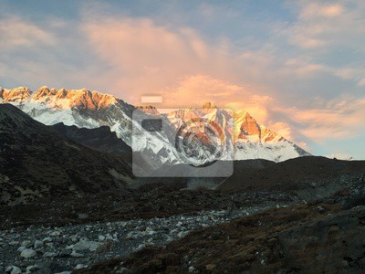
mt. Lhotse południe twarz, Himalaje, Nepal
mt. Everest z Gokyo Ri o zachodzie słońca.
Chiang Mai. Tajlandia. miasto Chiang Mai w chmurach. Widok z Doi Suthep.
zobacz więcejschowaj

Nasz sklep internetowy używa plików cookies i pokrewnych technologii. Dzięki nim zapewniamy najwyższą jakość świadczonych usług i gwarantujemy płynne działanie strony. Po uzyskaniu Twojej zgody, pliki cookies będą również wykorzystane do dodatkowych pomiarów i analizy korzystania z witryny. Pozwoli nam to dostosować stronę do Twoich zainteresowań oraz prezentować spersonalizowane treści i reklamy.
Administratorem Twoich danych jest Fairbox Sp. z o.o., a w niektórych sytuacjach także nasi partnerzy, z którymi współpracujemy. Szczegółowe informacje dotyczące korzystania z plików cookie oraz przetwarzania Twoich danych osobowych znajdziesz w naszej Polityce Prywatności i Cookies.
Ustawienia plików cookies
Poniżej znajdziesz opisy poszczególnych kategorii plików cookies oraz możliwość dostosowania ich do swoich preferencji:
Niezbędne
Używamy ich do zapewnienia poprawnego działania strony internetowej. Dzięki nim możesz bez zakłóceń poruszać się po naszym sklepie, a także bezpiecznie dokonywać zakupów.
Funkcjonalne
Służą do zapamiętywania wyborów dokonanych przez użytkowników na stronie, co pomaga dostosować witrynę do Twoich personalnych preferencji i poprawić komfort jej użytkowania.
Analityczne
Analityczne pliki cookies mierzą ilość wizyt i zbierają informacje o źródłach ruchu na stronie. Dzięki nim możemy zrozumieć sposób w jaki użytkownicy korzystają z witryny, doskonalić jakość usług oraz dostosowywać zawartość sklepu, aby lepiej spełniała oczekiwania naszych Klientów.
Marketingowe
Marketingowe pliki cookies umożliwiają nam i naszym partnerom dostosowanie treści reklamowych do Twoich zainteresowań. Służą także do wyświetlania reklam na innych stronach internetowych.