-42%  NA WSZYSTKIE PRODUKTY !
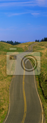
Obraz To Route 1 znany także jako Pacific Coast Highway. Skaliste zbocze widoczny jest również obok oceanu.
Obraz:
To Route 1 znany także jako Pacific Coast Highway. Skaliste zbocze widoczny jest również obok oceanu..
Autor:
Numer zdjęcia:
#58446004
Słowa kluczowe:
na wolnym powietrzu, woda, podróżować, transport, panoramiczne, morze, wakacje, Ameryka, szeroki
Podobne
This is Route 1also known as the Pacific Coast Highway. The road is situated next to the ocean with the mountains in the distance. The road goes off into infinity into the sunset.
Famous Road to Monument Valley Arizona/Utah border area, Navajo Indian Reservation
This is the Million Dollar Highway in the rain. The road is dark and wet. There are aspen trees with gold leaves on either side of the road.
This is Fossy Road in a fog.  It signifies hazardous driving conditions as you can only see a few feet of the road and the way ahead is obscured by the fog.
This is rush hour traffic on the 405 Freeway at sunset. There are 10 lanes of traffic total showing both sides of the freeway. There are cars stopped in every lane.
Famous Road to Monument Valley Arizona/Utah border area, Navajo Indian Reservation
This is a tree lined road at sunset. It is located on the Eastern Shore of Maryland. The road travels through the center of the trees.
JS999958
This is Route 1also known as the Pacific Coast Highway. The road is situated next to the ocean with the mountains in the distance. The road goes off into infinity into the sunset.
JS999989
To Route 163, który biegnie przez rezerwatu Indian Navajo. Droga biegnie się w środku, a maleje w nieskończoność. Czerwone skały Monument Valley są w tle. Rośliny peeling pustyni są po obu stronach dr
This is the Greylock State Reservation in autumn. There is a road that winds through the forest up to the right of the image.
This is the Ventura Pier at sunset.
This is the road on the Bixby Bridge. It is Route 1, also known as Pacific Coast Highway. It is next to the mountainous coast and the Pacific Ocean. The road curves around to the right.
To Rezerwacja Greylock State jesienią. Nie jest to droga, która wije się przez las do prawej stronie obrazu.
This is the Boone Hall Plantation. The trees are live oaks and Spanish moss. (Ouercusvirginia) They were planted in 1741. The small gravel road is travels through the center of the trees.
This is a freeway overpass intersection. It is the Interstate 10 & 15 in Southern California. The freeway criss-crosses over itself in several different directions.
This is Route 1 also known as the Pacific Coast Highway. The road curves around a bend to the left and drops down overlooking the ocean. The rocky hillside is also seen next to the ocean.
Ten znajduje się w Rain Forest Hoh. To pokazuje deszczu moczony drogi w złej pogody w otoczeniu zielonych drzew, paproci i liści otaczającego lasu deszczowego.
This is the north shore of the island of Oahu. On the right is a palm tree stretched above the sandy beach below. On the beach is a surfer and is surfboard walking alongside the ocean.
This is Julia Pfeifer Burns State Park. It shows McWay Cove with an 80 ft. waterfall spilling onto the beach and into the Pacific Ocean. There is a large rocky crag to the right of the waterfall.
Upper Ojai California in spring with Topa Topa Mountains
This is Route 1, also known as the Pacific Coast Highway. The ocean is to the right of the road which curves around a bend.
Pemaquid Point Lighthouse at sunrise, Maine
This is rush hour traffic on the 405 Freeway at sunset. There are 10 total lanes of traffic with cars traveling in both directions.
To jest Million Dollar Highway w deszczu. Droga jest ciemno i mokro. Istnieje Aspen drzew z liści złota po obu stronach drogi.
This is the Interstate 405 and 10 at rush hour. There are many cars lined up on the freeway with an overpass on the left hand side. There are a few houses to the right of the freeway.
This is a snow covered winter road in the Yosemite Valley. The road curves to the left and the trees are covered in snow. There are tire marks on the snowy road where cars have driven over the snow.
This is an aerial view of Cape Cod. We see the ocean on the left hand side and the new England town of Provincetown on the right.
These are yellow square umbrellas on the Ventura Beach. They protect their beach chairs that sit beneath them on the sandy beach.
This is the Golden Gate Bridge in San Francisco at sunrise. The view is from the Marin Headlands.
This is the Beacon Bridge which is over the Hudson River. It is a large steel bridge. The water and sky are blue.
This is a freeway overpass with the Dallas skyline visible behind it. The freeway curves and snakes around in a circle in front of the city.
Upper Ojai California in spring with Topa Topa Mountains
This is a road in spring in the Santa Ynez Mountains,. There are oak trees surrounding the road and a green field.
This is a road or driveway leading up to a house on a hill surrounded on both sides by a white fence. There is yard on either side with green trees in the background.
This is a small snow covered road after a winter snow storm. The road in front is a bridge with visible tire tracks from a car that has crossed the bridge.
This is Route 64 after it has snowed. There is snow on the trees and several cars have driven over the snowy road as you can see where they have driven.
Snowy Road on Hastings Mesa near Ridgway Colorado
This is a tree lined road outside of San Antonio. It shows a beautiful spring day with the road separating through the center of the green trees.
This is a rain soaked road showing bad weather. It is called the Foothill Parkway and is surrounded by green trees. It heads off into a curve toward the right.
This is the skyline from the Schuylkill River at sunset.
JS999984
JS999964
Jest to obraz o 360 stopni rozwidleniu dróg. Skały Monument Valley są małe w tle i nie jest pustynia liście na wszystkich stronach każdej drodze. Niebo jest niebieski z białej chmury puffy.
To Tower National Monument diabła. Ma ft elewacji 865-ga To był miejscem kręcenia filmu do filmu, Bliskie spotkania trzeciego dziecka. Jest kręta droga gruntowa prowadząca do pomnika.
This is a tree lined road at sunset. It is located on the Eastern Shore of Maryland. The road travels through the center of the trees.
To jest obraz z dwóch białych leżaki skierowane w stronę pobliskiego portu. Istnieje Łodzie rybackie zacumowane w porcie w tym małym homara wsi. Krzesła są otoczone zieloną trawę, a port ma jasny nieb
This is a road sign that says, View Area with a white arrow pointing to the right. The sign is against a blue sky with white clouds in the background.
This is the Cornish-Windsor Covered Bridge. It connects Vermont and New Hampshire at their borders. It is the world's longest covered bridge with 460 feet. It was built in 1866.
These are the old-fashioned twenty-five cent view binoculars for tourists. They are on the beach at Cape May. They are set against a blue sky with white puffy clouds.
This is a road sign that says, Scenic Area, with a white arrow pointing to the right. The sign has a blue background and is against a blue sky.
This is a road sign that says Panorama Point  showing the way to a view spot.
Pemaquid Point Lighthouse at sunrise, Maine
This is the morning view of Pine Island Sound. Its pier juts out from the left side with wooden pylons standing up out of the water near the shore.
This is the sand and rocky beach along the Oregon coast. There is a slight mist along the beach and patchy areas of grass growing along the beach as well.
These are small sailboats moored in Basin Harbor at sunset. Trees envelope the surrounding area outside of the harbor.
Waikiki Beach and Diamond Head Volcano in Honolulu, Hawaii
This is the turquoise water of the Atlantic Ocean sweeping onto the beach beneath the Pacific Coast Highway.
This is the interior of a tunnel. There is an orange glow from lights on the surrounding walls with a small light at the end of the tunnel. There is a road leading through the tunnel.
This is the Bixby Bridge that carries Route 1in Northern California. It is also Route 1 is also known as Pacific Coast Highway. The Pacific Ocean is to the right of the bridge.
This is Route 580 at the Altamont Pass. There is green grass on each side of the highway with two separate roads for cars to travel in each direction.
This is the Golden Gate National Recreation Area at Mount Tamalpais. There is a winding spring road with no cars on it.
This is Nevada's first state park in red rock country. There is a sandstone arch that forms a window. It reveals a road that curves in a letter s shape.
This is a western road that goes on into infinity. There is a blue sky with white puffy clouds.
This is a country road with a farm on the right hand side of the road. It has a red barn and silo.
This is a snowy road at sunrise. It shows Winter in New England with snow in the trees and tire tracks through the snow on the road. The road is lined on either side with trees.
This is located in the Hoh Rain Forest. It shows a rain soaked road in bad weather surrounded by green trees, ferns and foliage of the surrounding rain forest.
This is Route 90 showing the wet road in the rain. There is autumn foliage on the shrubbery and a white car headed north on the road. There is steam coming from the car as it travels on the wet road.
This is the Indianapolis State Capitol and town center in morning light. There is a large road leading into the city in the foreground.
This is Oahu Island in daylight. It is the view from Diamond Head Volcano.
This is the freeway to the center of the city with the skyline in the background. The Chase Tower is the building in the center.
JS999993
This is the Greylock State Reservation in autumn. There is a road that winds through the forest up to the right of the image.
JS999958
JS999989
Jest to skrzyżowanie autostrady wiadukt. To Interstate 10 i 15 w Południowej Kalifornii. Autostrady przecinających krzyże na siebie w kilku różnych kierunkach.
zobacz więcejschowaj
Materiały

Obraz na płótnie

Nadruk nanoszony jest na wysokiej jakości płótno, które naciąga się na krosno malarskie (blejtramy). Dzięki temu, że nadruk pokrywa boczne krawędzie, nie ma konieczności oprawiania wzoru dodatkową ramą. Polecamy również kompozycje składające się z kilku obrazów tworzących spójną kompozycję.
  • Montaż: Obraz jest od razu gotowy do zawieszenia na ścianie. Do każdego obrazu dokładamy zawieszki i gwoździki.
  • Dodatkowe informacje: W ofercie dostępne są ramy wewnętrzne i zewnętrzne.

Zobacz również
Są wydmy w świetle poranka.
Ratownik krzesło na plaży w godzinach porannych, Cape May, New Jersey
Monety lornetki oglądalności turystów, Cape May, New Jersey
Są to domy w stylu wiktoriańskim z widokiem na plaży w Cape May. Jest drewniany płot oddzielający plażę i domy. Domy mają duże przednie ganki. Niebo jest ciemnoniebieskie z zaledwie kilku białej chmur
Wschód słońca nad jeziorem i Sawtooth Karmazyn Górach, Idaho
Mount Moran w Grand Teton National Park w pobliżu Jackson, Wyoming
Grand Tetons i refleksji w Grand Teton National Park, Wyoming
Grand Tetons odzwierciedlenie w Oxbow Bend, Wyoming
Buffalo wypas, Park Narodowy Yellowstone, Wyoming
Jest to pierwszy park stanu Nevada w Red Rock kraju. Po lewej stronie jest ściana z piaskowca z widokiem Biały Dome Rock Road.
Szczyt ten jest Piramida w Maroon Bells po burzy śnieżnej zimy. Wysokość wynosi 14,010 stóp.
To Route 1 znany także jako Pacific Coast Highway. Krzywe dróg zakręt w lewo i spada z widokiem na ocean. Skaliste zbocze widoczny jest również obok oceanu.
Stogi siana i śnieg, Moose-Wilson Road, Jackson, Wyoming
Diabelski Tower National Monument, Wyoming
Grand Tetons, Grand Teton National Park, Wyoming
Jesień w Grand Teton Grand Teton National Park, Wyoming
Zachód słońca nad osiki and Bear Tooth w Pilot Mountain, Wyoming
Jackson Lake i Grand Tetons, Grand Teton National Park, Wyoming
Grand Tetons i drzewa bawełny w Grand Teton National Park, Wyoming
Snake River i Grand Tetons, Grand Teton National Park, Wyoming
Sunrise Grand Teton Grand Teton National Park, Wyoming
Jackson Lake i Grand Tetons, Grand Teton National Park, Wyoming
Zachód słońca w Jackson Lake i Grand Teton Grand Teton National Park, Wyoming
Unia Obóz Paper Mill, Savannah River Gruzja
To jest Golden Gate Bridge na zachodzie słońca. To jest widok z Marin pasy ziemi. Skyline jest mały w oddali.
Ghost Town, Cody, Wyoming
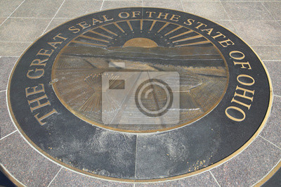
State Capitol of Ohio, Columbus
This is the south rim of the Grand Canyon at Mather Point at sunset.
Bryce Canyon National Park, Utah
This is known as Slot Canyon. It is located in the Antelope Desert Canyon. It shows sandstone patterns on the walls.
Eagle Harbor, Lake Superior, Michigan
Jest to letni deszcz Burza nad pole pszenicy. Burza chmury są szare nad polem.
South Rim View Point, Wielki Kanion, Arizona
Wal Ket Szczyt pobliżu Tonalea, Arizona
Deserted Car with Cow Skeleton, Great Basin, Nevada
South Rim View Point, Wielki Kanion, Arizona
Jest to gospodarstwo Midwest. Ma czerwona stodoła i zboże rosnące na polu.
Jest to sylwetka rolnik na ciągniku na Środkowym Zachodzie. To pokazuje rolnictwa obszarów wiejskich na zachodzie słońca.
State Capitol of Ohio, Columbus
Szczyt komina w Uncompahgre National Forest, Ridgeway, Colorado
Wschód słońca nad jeziorem, St. Mary Glacier National Park, Montana
Giant Sequoia drzew, Sequoia National Park, Kalifornia
JS999965
Kowboj na koniu z liny na PRCA Rodeo na Dolnym Brule, Lyman County, Lower Brule Sioux Tribal Reservation, Południowa Dakota, 58 mil na południowym wschodzie Pierre pobliżu Missouri River, 10 sierpnia
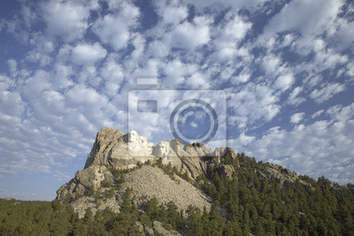
Białe chmury puffy za prezydenci George Washington, Thomas Jefferson, Teddy Roosevelt i Abraham Lincoln na Mount Rushmore National Memorial, Dakota Południowa
A profil prezydenci George Washington, Thomas Jefferson, Teddy Roosevelt i Abraham Lincoln na Mount Rushmore National Memorial, Dakota Południowa
Park ranger i fotograf stoi wyżej Abraham Lincoln na Mount Rushmore National Memorial, South Dakota
Białe chmury puffy za prezydenci George Washington, Thomas Jefferson, Teddy Roosevelt i Abraham Lincoln na Mount Rushmore National Memorial, Dakota Południowa
Wschód słońca na prezydenci George Washington, Thomas Jefferson, Teddy Roosevelt i Abraham Lincoln na Mount Rushmore National Memorial, South Dakota
Zamknij się prezydent George Washington na Mount Rushmore National Memorial, Dakota Południowa
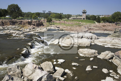
Sioux Falls Wodospad na rzece Big Sioux, Sioux Falls, Dakota Południowa
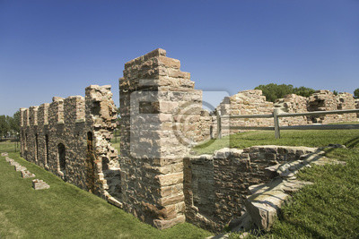
Ruiny Zabytkowy młyn wodny w Parku Big Sioux Falls nad rzeką, Sioux Falls, Dakota Południowa.
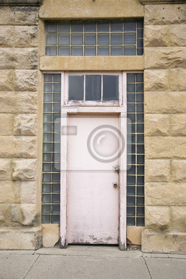
Różowy drzwi, Hot Springs, Dakota Południowa
Zachodnie zachód słońca i spektakularne chmury, Hot Springs, Dakota Południowa
Złoty jasny maki górujące nad zielonymi wzgórzami Figueroa Mountain w pobliżu Spring Santa Ynez i Los Olivos, Kalifornia
To Eastern Shore of Maryland. Są to białe drewniane leżaki siedzi na trawniku. Są one patrząc na Chesapeake Bay od Morris Inn. Nie jest duży zielony leafed drzewa na lewo, a piaszczysta plaża naprzeci
To Salt Ash Inn Bed and Breakfast. Jest to duży biały dom z dużym ganku. Jest to blisko z ganku z kolorowych drewnianych krzeseł przed oknami. Okna mają czarni okiennice na nich.
Route 62 na jasny słoneczny dzień jesieni, droga do Telluride Kolorado od Ridgeway, Southwestern Colorado
Białe chmury w błękitne niebo
Watchtower, Grand Canyon National Park, Arizona
Cottonwood Tree In Grand Teton National Park, Jackson, Wyoming
Church of Transfiguration, Grand Teton National Park, Wyoming
To jest Golden Gate National Recreation Area na Mount Tamalpais. Jest kręta droga bez samochodów na skoki go.
Jest to znane jako łuki Windows. To zostało zrobione o świcie.
To Capitol i centrum miasta Indianapolis państwa w świetle poranka. Istnieje duża drogi prowadzącej do miasta na pierwszym planie.
To jest wschód słońca Allegheny i Kolejka linowo-terenowa na rzekach gdzie spotykają się rzeki Ohio. To jest widok z Mount Washington.
Statua Indian na koniu, Grant Park, Chicago, Illinois
Grand Teton National Park, Jackson, Wyoming
Grand Teton National Park jesienią, Jackson, Wyoming
zobacz więcejschowaj

Nasz sklep internetowy używa plików cookies i pokrewnych technologii. Dzięki nim zapewniamy najwyższą jakość świadczonych usług i gwarantujemy płynne działanie strony. Po uzyskaniu Twojej zgody, pliki cookies będą również wykorzystane do dodatkowych pomiarów i analizy korzystania z witryny. Pozwoli nam to dostosować stronę do Twoich zainteresowań oraz prezentować spersonalizowane treści i reklamy.
Administratorem Twoich danych jest Fairbox Sp. z o.o., a w niektórych sytuacjach także nasi partnerzy, z którymi współpracujemy. Szczegółowe informacje dotyczące korzystania z plików cookie oraz przetwarzania Twoich danych osobowych znajdziesz w naszej Polityce Prywatności i Cookies.
Ustawienia plików cookies
Poniżej znajdziesz opisy poszczególnych kategorii plików cookies oraz możliwość dostosowania ich do swoich preferencji:
Niezbędne
Używamy ich do zapewnienia poprawnego działania strony internetowej. Dzięki nim możesz bez zakłóceń poruszać się po naszym sklepie, a także bezpiecznie dokonywać zakupów.
Funkcjonalne
Służą do zapamiętywania wyborów dokonanych przez użytkowników na stronie, co pomaga dostosować witrynę do Twoich personalnych preferencji i poprawić komfort jej użytkowania.
Analityczne
Analityczne pliki cookies mierzą ilość wizyt i zbierają informacje o źródłach ruchu na stronie. Dzięki nim możemy zrozumieć sposób w jaki użytkownicy korzystają z witryny, doskonalić jakość usług oraz dostosowywać zawartość sklepu, aby lepiej spełniała oczekiwania naszych Klientów.
Marketingowe
Marketingowe pliki cookies umożliwiają nam i naszym partnerom dostosowanie treści reklamowych do Twoich zainteresowań. Służą także do wyświetlania reklam na innych stronach internetowych.