-42% NA WSZYSTKIE PRODUKTY !


Podobne


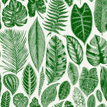
 Materiały
Zobacz również


Naklejka standard
Białe elementy motywu zostaną wydrukowane nieprzezroczyście.
Drukowana jest na samoprzylepnej folii PCV, która znakomicie sprawdza się na gładkiej powierzchni. Idealnie nadaje się do oklejania np. mebli, drzwi, szyb, urządzeń gospodarstwa domowego. Istnieje możliwość wycięcia wzoru wzdłuż jego konturów. W celu realizacji tego typu zamówienia skontaktuj się z obsługą klienta.
Drukowana jest na samoprzylepnej folii PCV, która znakomicie sprawdza się na gładkiej powierzchni. Idealnie nadaje się do oklejania np. mebli, drzwi, szyb, urządzeń gospodarstwa domowego. Istnieje możliwość wycięcia wzoru wzdłuż jego konturów. W celu realizacji tego typu zamówienia skontaktuj się z obsługą klienta.
- Maksymalna szerokość jednego brytu naklejki: 133 cm. W przypadku rozmiaru przekraczającego maksymalną szerokość materiału, wydruk będzie składał się z kilku równych arkuszy.
- Polecane zastosowanie: gładkie powierzchnie, meble, drzwi, szyby, urządzenia gospodarstwa domowego
- Czyszczenie: można delikatnie przemywać wilgotną szmatką
- Wykończenie: mat
Naklejka witrażowa
Wydrukowana na przezroczystej folii. Po zamontowaniu na szybie daje efekt barwionego szkła.
Znakomicie nadaje się do dekoracji okien i przeszklonych drzwi, zarówno wejściowych, wewnętrznych, jak i meblowych. Nadaje się również do oklejania gładkich ścian. Możliwe wycięcie wzoru po obrysie. W tym celu skontaktuj się z obsługą klienta.
Znakomicie nadaje się do dekoracji okien i przeszklonych drzwi, zarówno wejściowych, wewnętrznych, jak i meblowych. Nadaje się również do oklejania gładkich ścian. Możliwe wycięcie wzoru po obrysie. W tym celu skontaktuj się z obsługą klienta.
- Maksymalna szerokość jednego brytu naklejki: 133 cm. W przypadku rozmiaru przekraczającego maksymalną szerokość materiału, wydruk będzie składał się z kilku równych arkuszy.
- Polecane zastosowanie: gładkie ściany, szkło, szyby, przeszklone meble
- Czyszczenie: można delikatnie przemywać wilgotną szmatką
- Wykończenie: błysk
Naklejka frontstick
Drukowana jest na samoprzylepnej folii przezroczystej, zabezpieczonej białą maską.
Klej znajduje się od strony wydruku, dlatego wzór przykleja się od wewnętrznej powierzchni szyby. Dzięki temu ozdoba nie jest narażona na żadne uszkodzenia. Można ją umieścić nie tylko na szklanej powierzchni, ale również na innych przezroczystych materiałach, jak np. pleksi. Naklejka nadaje się znakomicie do odmiany wyglądu przeszklonych mebli i drzwi. Białe elementy wydruku po naklejeniu nie są przezroczyste.
Klej znajduje się od strony wydruku, dlatego wzór przykleja się od wewnętrznej powierzchni szyby. Dzięki temu ozdoba nie jest narażona na żadne uszkodzenia. Można ją umieścić nie tylko na szklanej powierzchni, ale również na innych przezroczystych materiałach, jak np. pleksi. Naklejka nadaje się znakomicie do odmiany wyglądu przeszklonych mebli i drzwi. Białe elementy wydruku po naklejeniu nie są przezroczyste.
- Maksymalna szerokość jednego brytu naklejki: 130 cm. W przypadku rozmiaru przekraczającego maksymalną szerokość materiału, wydruk będzie składał się z kilku równych arkuszy.
- Polecane zastosowanie: szklane części mebli i drzwi, szyby pojazdów, witryny sklepowe i okna wystawowe, szklane panele kuchenne między górnymi i dolnymi szafkami.
- Czyszczenie: można przecierać wilgotną szmatką
- Wykończenie: błysk
Naklejka magnes
Naklejka standardowa (nieprzezroczysta), ale na podłożu magnesowym.
Dzięki warstwie magnesu naklejkę można montować i demontować na dowolnych sprzętach AGD bez potrzeby klejenia. Technologia HP Latex zapewnia żywe, nieblaknące kolory na wiele lat.
Dzięki warstwie magnesu naklejkę można montować i demontować na dowolnych sprzętach AGD bez potrzeby klejenia. Technologia HP Latex zapewnia żywe, nieblaknące kolory na wiele lat.
- Maksymalna szerokość jednego brytu naklejki: 125 cm. W przypadku rozmiaru przekraczającego maksymalną szerokość materiału, wydruk będzie składał się z kilku równych arkuszy.
- Polecane zastosowanie: powierzchnie magnetyczne, sprzęt AGD
- Czyszczenie: można delikatnie przemywać wilgotką szmatką.
- Wykończenie: mat