-42%  NA WSZYSTKIE PRODUKTY !
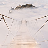
Fototapeta View at Kausani, a hill station in Bageshwar district, Uttarakhand, India.
Fototapeta:
View at Kausani, a hill station in Bageshwar district, Uttarakhand, India..
Autor:
Numer zdjęcia:
#234996981
Słowa kluczowe:
alpejski, jesień, tło, piękny, łańcuch, chmura, kolorowy, świt, cel
Podobne
View of Mcleod ganj town from Triund hiking trail at Dharamsala, Himachal Pradesh, India.
View of Himalayas mountain range with visible silhouettes through the colorful fog from Khalia top trek trail. Khalia top is at an altitude of 3500m himalayan region of Kumaon, Uttarakhand, India.
View enroute to Prashar Lake trekk trail through river bed. It is located at a height of 2730 m above sea level surrounded by lesser himalayas peaks near Mandi, Himachal Pradesh, India.
Mesmerizing view of cloudy red sunset sky background during sunset enroute to Triund trekking trail from Mcleodganj, Dhramshala, Himachal Pradesh, India.
View enroute to Triund hiking trail through lush green landscape at Mcleod ganj, Dharamsala, Himachal Pradesh, India. Triund hill top offers view of himalyan peaks of Dhauladhar range.
Nako Lake aerial view from Nako Village Top. Nako Lake is a high altitude lake located at 3662m from sea level in Kinnaur region of Himachal Pradesh, India
View of Himalays during sunrise at Binsar, a hill station in Almora district, Uttarakhand, India.
View at Kausani, a hill station in Bageshwar district, Uttarakhand, India.
Panoramic landscape of great Himalayas mountain range during an autumn morning from Kausani also known as 'Switzerland of India' a hill station in Bageshwar district, Uttarakhand, India.
Nainital Lake is a natural freshwater body formed by tectonics. It is a popular tourist destination to enjoy vacations among tourist who visits most popular hill station Nainital in Kumaon region.
This is the view from Pantwari village,base location for Nag tibba trekk. Nag Tibba is the highest peak  at an altitude of 9,915ft in the lesser himalayan region of Garhwal, Uttarakhand, India.
Panoramic view during sunset over snow cladded Panchchuli peaks falls in great Himalayan mountain range from small hamlet Munsiyari, Kumaon region, Uttarakhand, India.
View of Himalayas mountain range with visible silhouettes through the colorful fog from Khalia top trek trail. Khalia top is at an altitude of 3500m himalayan region of Kumaon, Uttarakhand, India.
Mesmerizing view at Deoria Tal or Lake nestled in Garhwal Himalayas at  Chopta, Uttarakhand, India. This lake is a camping location for Tungnath Chandrashila hiking trail.
View from hilly mountain road travelling through Himalayas mountains near Chitkul, Kalpa Kinnaur, Himachal Pradesh, India.
View of Himalayas mountain range with visible silhouettes through the colorful fog from Binsar Zero point trek trail in  himalayan region of Kumaon, Uttarakhand, India.
Snow covered beautiful landscape of Chandra river valley in Spiti during winter. Spiti means 'The Middle Land' is a cold desert mountain valley located high in Himalayas of Himachal Pradesh, India.
View at Binsar of the Kumaon region, Almora, Uttarakhand.
Panoramic landscape of braided Spiti river valley and snow capped mountains during sunrise from Losar village near Kaza town in Lahaul and Spiti district of Himachal Pradesh, India.
Mesmerizing view en-route to Rohtang pass of Pir Panjal himalayas mountain range on leh Manali highway, Himachal Pradesh, India.
Panoramic Landscape of Spiti valley with snow capped mountains in background near agriculture fields of Hikkim and Komic village of Kaza town in Lahaul and Spiti district of Himachal Pradesh, India.
Serene Landscape of Spiti river valley & snow capped mountains during sunrise near Kaza town in Lahaul & Spiti district of Himachal Pradesh, India.
Spectacular view during sunset in Himalayas on an autumn evening from Chandrashila hiking trail at Chopta Uttarakhand India.
Panoramic view during sunset over snow cladded Panchchuli peaks falls in great Himalayan mountain range from small hamlet Munsiyari, Kumaon region, Uttarakhand, India.
View of Himalayas mountain range with visible silhouettes through the colorful fog from Khalia top trek trail. Khalia top is at an altitude of 3500m himalayan region of Kumaon, Uttarakhand, India.
Serene Landscape of Baspa river valley near Chitkul village in Kinnaur district of Himachal Pradesh, India. It is the last inhabited village near the Indo-China border.
Panoramic view during sunset over snow cladded Panchchuli peaks falls in great Himalayan mountain range from small hamlet Munsiyari, Kumaon region, Uttarakhand, India.
View of Himalayas mountain range with visible silhouettes through the colorful fog from Khalia top trek trail. Khalia top in himalayan region of Kumaon, Uttarakhand, India.
View during sunset enroute to Tungnath-Chandrashila hiking trail in Chopta, Uttarakhand, India
View enroute to Tungnath-Chandrashila hiking trail in Chopta, Uttarakhand, India
Mesmerizing  sunset view at  Munsiyari, Uttarakhand, India.
Mesmerizing view at Deoria Tal or Lake nestled in Garhwal Himalayas at  Chopta, Uttarakhand, India. This lake is a camping location for Tungnath Chandrashila hiking trail.
Panoramic view during sunset over snow cladded Panchchuli peaks falls in great Himalayan mountain range from Khalia top trekk trail at small hamlet Munsiyari, Kumaon region, Uttarakhand, India.
Spectacular panoramic cityscape of Rishikesh during sunrise, the yoga capital of World located in foothills Himalayas along banks of river Ganga or Ganges in Uttarakhand state of India.
View enroute to Zero point, Binsar trekking trail through evergreen forest which offers splendid view of Himalayas of the Kumaon region, Uttarakhand.
View of Himalays during sunrise at Binsar, a hill station in Almora district, Uttarakhand, India.
View at Kausani, a hill station in Bageshwar district, Uttarakhand, India.
Panoramic landscape of great Himalayas mountain range during an autumn morning from Kausani also known as 'Switzerland of India' a hill station in Bageshwar district, Uttarakhand, India.
Silhouette of  forested himalayas mountain slope with the evergreen fir conifers shrouded in misty landscape view from prashar lake base camp at height of 2730 m  near Mandi, Himachal Pradesh, India.
Sunset view of golden sunrays  at Nag Tibba or Serpent's summit, it is  highest peak in the lesser himalayan region of Garhwal, Dehradun, Uttarakhand, India.
View of Himalayas mountain range with visible silhouettes through the colorful fog from Nag Tibba or Serpent's trail. It is highest peak in the lesser himalayan region of Garhwal, Uttarakhand, India.
Mesmerizing view of Kamet, Parvati and Neelkanth mountains of Garhwal Himalayas from Kuari pass hiking trail near Auli, Uttarakhand, India.
Mesmerizing view of Himalaya during sunset from Kuari pass hiking trail near Auli, Uttarakhand, India.
Mesmerizing view of Kamet, Parvati and Neelkanth mountains of Garhwal Himalayas from Kuari pass hiking trail near Auli, Uttrakhand, India.
Mesmerizing view of Kamet, Parvati and Neelkanth mountains of Garhwal Himalayas from Kuari pass hiking trail near Auli, Uttarakhand, India.
Serene Landscape of Baspa river valley near Chitkul village in Kinnaur district of Himachal Pradesh, India. It is the last inhabited village near the Indo-China border.
View enroute to Triund hiking trail through lush green landscape at Mcleodganj, Dharamsala, Himachal Pradesh, India. Triund hill top offers view of Himalayas peaks of Dhauladhar range.
View from Binsar Zero point watch tower during sunset at Binsar wildlife sanctuary at Binsar, Uttarakhand, India.
Beautiful panoramic cityscape of Kausani also known as 'Switzerland of India' a hill station in Bageshwar district, Uttarakhand, India.
Nainital Lake is a natural freshwater body formed by tectonics. It is a popular tourist destination to enjoy vacations among tourist who visits most popular hill station Nainital in Kumaon region.
Serene Landscape of Spiti river valley with agriculture fields and Rangrik village in background near Kaza town in Lahaul and Spiti district of Himachal Pradesh, India.
Pine tree forest  on mountain slopes of Himalayas mountains of Binsar wildlife sanctuary at Almora, Uttarakhand, India. Sustainable industry, ecosystem and healthy environment concepts and background.
View of Himalays during sunrise at Binsar, a hill station in Almora district, Uttarakhand, India.
Snow covered beautiful landscape of Chandra river valley in Spiti during winter. Spiti means 'The Middle Land' is a cold desert mountain valley located high in Himalayas of Himachal Pradesh, India.
Autumn forest landscape of Himalayas at Chitkul, Sangla Valley, Himachal Pradesh, India.
View enroute to Triund hiking trail through lush green landscape at Mcleodganj, Dharamsala, Himachal Pradesh, India. Triund hill top offers view of Himalayas peaks of Dhauladhar range.
Milky Bhagsunag waterfall at McLeod Ganj in Dharamsala, Himachal Pradesh, India
zobacz więcejschowaj
Materiały

Fototapeta lateksowa

Powstaje z materiału lateksowego o gładkiej i matowej powierzchni dającej fotograficzny efekt. Wykorzystana technologia HP Latex zapewnia żywe i nieblaknące kolory odporne na promienie UV.
  • Maksymalna szerokość jednego brytu fototapety: 95 cm lub 105 cm w zależności od dostępności danego materiału. Żeby zapewnić podział taki, jakiego potrzebujesz, prosimy o zamieszczenie informacji o wybranej szerokości w komentarzu do zamówienia. Jeśli Twój wymiar będzie przekraczał maksymalną szerokość materiału, wydruk będzie się składał z kilku równych arkuszy.
  • Polecane zastosowanie: salon, sypialnia, przedpokój, pokój dziecięcy, sala konferencyjna.
  • Sposób klejenia: krawędź w krawędź
  • Czyszczenie: można przecierać suchą szmatką
  • Wykończenie: półmat

Fototapeta winylowa na flizelinie

Drukowana jest na matowym, wyjątkowo solidnym i odpornym materiale na podkładzie flizelinowym. Zapewnia to doskonałą trwałość i odporność na rozciąganie oraz odkształcenia. Materiał przepuszcza parę wodną, dzięki czemu ściany oddychają, a produkt nadaje się do kuchni i łazienki. Technologia HP Latex zapewnia żywe kolory na lata.
  • Maksymalna szerokość jednego brytu fototapety: 95 cm lub 105 cm w zależności od dostępności danego materiału. Żeby zapewnić podział taki, jakiego potrzebujesz, prosimy o zamieszczenie informacji o wybranej szerokości w komentarzu do zamówienia. W przypadku rozmiaru przekraczającego maksymalną szerokość materiału, wydruk będzie się składał z kilku równych arkuszy.
  • Polecane zastosowanie: salon, sypialnia, kuchnia, łazienka, przedpokój, pokój dziecięcy, hotel, restauracja, sala konferencyjna, budynki użytku publicznego, szkoły, przedszkola, żłobki.
  • Sposób klejenia: krawędź w krawędź. Nakładanie kleju tylko na ścianę znacznie ułatwia montaż.
  • Czyszczenie: można przecierać wilgotną szmatką
  • Wykończenie: półmat

Fototapeta winylowa na flizelinie struktura

Drukowana jest na wyjątkowo trwałym i odpornym podkładzie flizelinowym, którego grubość zmniejsza niewielkie nierówności na powierzchni ściany. Półmatowy materiał i struktura drobnego piasku na powierzchni dają ekskluzywny efekt. Fototapeta przepuszcza parę wodną, dzięki czemu ściany oddychają, a wzór nadaje się do kuchni i łazienki. Technologia HP Latex zapewnia żywe kolory na lata.
  • Maksymalna szerokość jednego brytu fototapety: 100 cm. Żeby zapewnić podział taki, jakiego potrzebujesz, prosimy o zamieszczenie informacji o wybranej szerokości w komentarzu do zamówienia. Gdy rozmiar przekracza maksymalną szerokość materiału, wydruk będzie się składał z kilku równych arkuszy.
  • Polecane zastosowanie: salon, sypialnia, kuchnia, łazienka, przedpokój, hotel, restauracja, sala konferencyjna, budynki użytku publicznego.
  • Sposób klejenia: krawędź w krawędź. Nakładanie kleju tylko na ścianę znacznie ułatwia montaż.
  • Czyszczenie: można przecierać wilgotną szmatką
  • Wykończenie: półmatowe, struktura drobnego piasku
  • Dodatkowe informacje: specjalna gramatura 255g/m2

Fototapeta samoprzylepna

To uniwersalny i praktyczny produkt, który sprawdzi się na większości gładkich powierzchni. Wzór można umieścić na ścianie, meblach i szklanych płaszczyznach. Specjalnie opracowany klej gwarantuje łatwe przyklejenie fototapety, dzięki czemu znacznie skracamy czas odmiany wnętrza. Technologia HP Latex zapewnia żywe kolory na lata.
  • Maksymalna szerokość jednego brytu fototapety: 133 cm. W przypadku rozmiaru przekraczającego maksymalną szerokość materiału, wydruk będzie się składał z kilku równych arkuszy.
  • Polecane zastosowanie: salon, sypialnia, kuchnia, przedpokój, pokój dziecięcy, hotel, restauracja, sala konferencyjna, budynki użytku publicznego, szkoły, przedszkola, żłobki.
  • Sposób klejenia: krawędź w krawędź, łatwe przyklejanie
  • Czyszczenie: można delikatnie przemywać wilgotną szmatką
  • Wykończenie: mat

Zobacz również
Serene Landscape of Baspa river valley near Chitkul village in Kinnaur district of Himachal Pradesh, India. It is the last inhabited village near the Indo-China border.
snowman in snow at Dalhousie, Himachal Pradesh, India.
Village in the mountains in the morning at Dalhousie, Himachal Pradesh, India.
Rainbow and trees in the mountains at Dalhousie, Himachal Pradesh, India.
Village in the mountains in the morning at Dalhousie, Himachal Pradesh, India.
Snowman at Dalhousie, Himachal Pradesh, India.
aerial view of the mountains at Dalhousie, Himachal Pradesh, India
mountain landscape view at Dalhousie, Himachal Pradesh, India
Safdarjung's Tomb  is a red sandstone & marble mausoleum in Delhi, India. It was built in 1753-54 by nawab 'Shuja-ud-Daulah' as tribute to his father 'Mirza Abul Mansur Khan' entitled 'Safdarjung'.
View of Himalayas mountain range with visible silhouettes through the colorful fog from Khalia top trek trail. Khalia top is at an altitude of 3500m himalayan region of Kumaon, Uttarakhand, India.
Deer Park Forest during an autumn morning in South Delhi, India
Silhouette of  forested himalayas mountain slope with the evergreen fir conifers shrouded in misty landscape view from prashar lake base camp at height of 2730 m  near Mandi, Himachal Pradesh, India.
Amber Fort built of Red Sandtsone & Marble in artistic Hindu style elements at Jaipur. Amer Fort is a primary tourist attraction & UNESCO World Heritage site in 'Hill forts of  Rajasthan, India'.
Amer Fort is a primary tourist attraction & UNESCO World Heritage site in 'Hill forts of Jaipur, Rajasthan, India'.
Safdarjung's Tomb  is a red sandstone & marble mausoleum in Delhi, India. It was built in 1753-54 by nawab 'Shuja-ud-Daulah' as tribute to his father 'Mirza Abul Mansur Khan' entitled 'Safdarjung'.
View of Himalayas mountain range with visible silhouettes through the colorful fog from Khalia top trek trail. Khalia top is at an altitude of 3500m himalayan region of Kumaon, Uttarakhand, India.
View from hilly mountain road travelling through Himalayas mountains near Munsiyari, Uttarakhand, India.
Panoramic view of Snow cladded  peaks falls in great Himalayan mountain range and alpine grass meadows at small hamlet Munsiyari, Kumaon region, Uttarakhand, India.
View from hilly mountain road travelling through Himalayas mountains near Munsiyari, Uttarakhand, India.
View of Highland agricultural step terrace fields of wheat during sunrise in the indian himalayan village region of Kumaon, Uttarakhand, India.
View from hilly mountain road travelling through Himalayas mountains near Munsiyari, Uttarakhand, India.
View from hilly  curvy mountainous road with flock of sheep walking on the mountain road through alpine landscape in Uttarakhand, India.
Himalayan mountain village at Uttarakhand, India.
Marasmius oreades, Scotch bonnet,also known as fairy ring mushroom or fairy ring champignon.  A mushroom is fleshy, spore-bearing fruiting body of a fungus, typically produced above ground on soil.
View of Ramganga river and the valley to the village and fields on the background of blue mountain ranges of the Himalayas, near Nainital, Uttarakhand, India.
View during sunset from Chittor or Chittorgarh Fort with city in backdrop. It is one of the largest forts in India &  listed in the UNESCO World Heritage Sites list as Hill Forts of Rajasthan.
Jaswant Thada is cenotaph built by King Sardar Singh of Jodhpur State in 1899. Mausoleum built of carved sheets of marble & was used for cremation of the royal family of Marwar, Rajasthan,India.
View of Ramganga river and the valley to the village and terrace fields on the background of blue mountain ranges of the Himalayas, near Nainital, Uttarakhand, India.
Panoramic view during Sunrise at the Jal Mahal 'Water Palace'. It is an architectural showcase of Rajput style in the Man Sagar lake in jaipur city, the capital of Rajasthan, India.
Panoramic aerial view of Udaipur city also known as city of lakes from  Monsoon palace at Sajjangarh, Rajasthan. It is the historic capital of the kingdom of Mewar.
Silhouette of  forested himalayas mountain slope with the evergreen fir conifers shrouded in misty landscape view from prashar lake base camp at height of 2730 m  near Mandi, Himachal Pradesh, India.
View at Prashar Lake located at a height of 2730 m above sea level with a three storied pagoda-like temple of sage Prashar near Mandi, Himachal Pradesh, India. The lake has a floating island in it
View enroute to Prashar Lake trekk trail. It is located at a height of 2730 m above sea level surrounded by lesser himalayas peaks near Mandi, Himachal Pradesh, India.
Qutub Minar is a highest minaret in India standing 73 m tall tapering tower of five storeys made of red sandstone and marble established in 1192. It is UNESCO world heritage site at  New Delhi,India
Amber Fort built of Red Sandtsone & Marble in artistic Hindu style elements at Jaipur. Amer Fort is a primary tourist attraction & UNESCO World Heritage site in 'Hill forts of  Rajasthan, India'.
View during sunset from Chittor or Chittorgarh Fort with city in backdrop. It is one of the largest forts in India &  listed in the UNESCO World Heritage Sites list as Hill Forts of Rajasthan.
Columns with stone carving in courtyard of Quwwat-Ul-Islam mosque, Qutub Minar complex. It is UNESCO world heritage site at  New Delhi,India
Red Fort is a historic fort UNESCO world Heritage Site at Delhi. On Independence day, the Prime Minister hoists Indian flag at main gate of fort & delivers nationally broadcast speech from its rampart
Humayun's tomb of Mughal Emperor Humayun designed by Persian architect Mirak Mirza Ghiyas in New Delhi, India. Tomb was commissioned by Humayun's wife Empress Bega Begum in 1569-70.
Qutub Minar is a highest minaret in India standing 73 m tall tapering tower of five storeys made of red sandstone and marble established in 1192. It is UNESCO world heritage site at  New Delhi,India
Panoramic view during sunset over snow cladded Panchchuli peaks falls in great Himalayan mountain range from Khalia top trekk trail at small hamlet Munsiyari, Kumaon region, Uttarakhand, India.
Mesmerizing view of Panchchuli peaks falls in great Himalayan mountain range and alpine grass meadows at small hamlet Munsiyari, Kumaon region, Uttarakhand, India.
Qutub Minar is a highest minaret in India standing 73 m tall tapering tower of five storeys made of red sandstone and marble established in 1192. It is UNESCO world heritage site at  New Delhi,India
View enroute to Tungnath-Chandrashila hiking trail in Chopta, Uttarakhand, India
Mountain silhouette of Panchchuli peaks during morning sunrise in great Himalayan mountain chain range from Khalia Top at small hamlet Munsiyari, Kumaon region, Uttarakhand, India.
This is the view of Himalayas Panchchuli peaks & alpine landscape from Khalia top trek trail at Munsiyari. Khalia top is at an altitude of 3500m himalayan region of Kumaon, Uttarakhand, India.
View of Snow cladded Panchchuli peaks falls in great Himalayan mountain range  & alpine grass meadows enroute to Khalia Top trekk trail at small hamlet Munsiyari, Kumaon region, Uttarakhand, India.
This is the view enroute to Khalia top trek trail through Himalayas autumn alpine grass landscape at Munsiyari. Khalia top is at an altitude of 3500m himalayan region of Kumaon, Uttarakhand, India.
Mesmerizing view at  Munsiyari, Uttarakhand, India.
View of spring foliage and mountains in Himalayas Mountains in Munsiyari, Uttarakhand, India.
Panoramic view during Sunrise at the Jal Mahal 'Water Palace'. It is an architectural showcase of Rajput style in the Man Sagar lake in jaipur city, the capital of Rajasthan, India.
Foliated rock Gneiss with distinct gneissic banding. It is derived by high-grade regional metamorphic processes of  shale a sedimentary rock in Gangotri Himalayas at  Uttarakhand,India.
Qutub Minar is a highest minaret in India standing 73 m tall tapering tower of five storeys made of red sandstone and marble established in 1192. It is UNESCO world heritage site at  New Delhi,India
Kumbhalgarh fort is a Mewar fortress built on Aravalli Hills in 15th century by King Rana Kumbha at  Rajsamand district ,near Udaipur. It is a World Heritage Site included in Hill Forts of Rajasthan.
The North Block of the building of the Secretariat. Central Secretariat is where the Cabinet Secretariat is housed, which administers the Government of India on Raisina Hill in New Delhi
The Sansad Bhawan or Parliament Building is the house of the Parliament of India, New Delhi.  It was designed by the British architect Edwin Lutyens and Herbert Baker in 1912-1913.
Catharanthus roseus is a plant in the dogbane family Apocynaceae. It is native to Madagascar but grown elsewhere as an ornamental & medicinal plant, as a source of drugs used to treat cancer.
View of abandoned Hut made of stones & mud with cloudy blue sky background during sunset enroute to Prashar Lake trekking trail from Baggi village, Mandi, Kullu Manali region, Himachal Pradesh, India.
Mesmerizing view at Kasol, Himachal Pradesh, India.
View of alpine meadows & coniferous enroute to Prashar Lake trekk trail. It is located at a height of 2730 m above sea level surrounded by lesser himalayas peaks near Mandi, Himachal Pradesh, India.
View at river side camp located in Uttarakhand, India.
View enroute to Prashar Lake trekk trail through small waterfall rivulet. It is located at a height of 2730 m above sea level surrounded by lesser himalayas peaks near Mandi, Himachal Pradesh, India.
View during spring season of the deer park adjacent to landmark Hauz Khas Complex which is now a tourist attraction in Delhi.
Prayer flags at Chandrashila summit of Deoria tal,tungnath chandrashila trekk in India Himalayas near Chopta Uttrakhand India.
Catharanthus roseus is a plant in the dogbane family Apocynaceae. It is native to Madagascar but grown elsewhere as an ornamental & medicinal plant, as a source of drugs used to treat cancer.
Qutub Minar is a highest minaret in India standing 73 m tall tapering tower of five storeys made of red sandstone and marble established in 1192. It is UNESCO world heritage site at  New Delhi,India
India Gate or All India War Memorial at New Delhi is a triumphal arch architectural style memorial designed by Sir Edwin Lutyens to 82,000 soldiers of the Indian Army who died in the First World War.
The North Block of the building of the Secretariat. Central Secretariat is where the Cabinet Secretariat is housed, which administers the Government of India on Raisina Hill in New Delhi
India Gate or All India War Memorial at New Delhi is a triumphal arch architectural style memorial designed by Sir Edwin Lutyens to 82,000 soldiers of the Indian Army who died in the First World War.
zobacz więcejschowaj

Nasz sklep internetowy używa plików cookies i pokrewnych technologii. Dzięki nim zapewniamy najwyższą jakość świadczonych usług i gwarantujemy płynne działanie strony. Po uzyskaniu Twojej zgody, pliki cookies będą również wykorzystane do dodatkowych pomiarów i analizy korzystania z witryny. Pozwoli nam to dostosować stronę do Twoich zainteresowań oraz prezentować spersonalizowane treści i reklamy.
Administratorem Twoich danych jest Fairbox Sp. z o.o., a w niektórych sytuacjach także nasi partnerzy, z którymi współpracujemy. Szczegółowe informacje dotyczące korzystania z plików cookie oraz przetwarzania Twoich danych osobowych znajdziesz w naszej Polityce Prywatności i Cookies.
Ustawienia plików cookies
Poniżej znajdziesz opisy poszczególnych kategorii plików cookies oraz możliwość dostosowania ich do swoich preferencji:
Niezbędne
Używamy ich do zapewnienia poprawnego działania strony internetowej. Dzięki nim możesz bez zakłóceń poruszać się po naszym sklepie, a także bezpiecznie dokonywać zakupów.
Funkcjonalne
Służą do zapamiętywania wyborów dokonanych przez użytkowników na stronie, co pomaga dostosować witrynę do Twoich personalnych preferencji i poprawić komfort jej użytkowania.
Analityczne
Analityczne pliki cookies mierzą ilość wizyt i zbierają informacje o źródłach ruchu na stronie. Dzięki nim możemy zrozumieć sposób w jaki użytkownicy korzystają z witryny, doskonalić jakość usług oraz dostosowywać zawartość sklepu, aby lepiej spełniała oczekiwania naszych Klientów.
Marketingowe
Marketingowe pliki cookies umożliwiają nam i naszym partnerom dostosowanie treści reklamowych do Twoich zainteresowań. Służą także do wyświetlania reklam na innych stronach internetowych.